
The distance between the Deanery inside Paul’s Churchyard, just southwest of the West Front of St Paul’s Cathedral, to the Tudor Gateway in Chancery Lane, the main access point for Lincoln’s Inn, was about eight tenths of a mile in 1623. One traveled from the Deanery through Ludgate, then westward on Fleet Street, turning right onto Chancery Lane, then preceeding north ward before turning left through the Gateway into the precincts of the Inn.
Donne certainly could have walked over from the Deanery — it is, today, about a fifteen minute walk — but I suspect he rode a horse, or, perhaps more likely, rode in a carriage, either on his own, or with George Montaigne, Bishop of London, and other members of the Bishop’s entourage.

The Inn’s website tells us that the great oak doors in the Gate House date from 1564. The Gate House itself was built during the years 1517 to 1521, with bricks dug and made within the Inn. Above the gateway, facing eastwards into Chancery Lane, there are the arms (from left to right) of Henry de Lacy, Earl of Lincoln; Henry VIII; and Sir Thomas Lovell.

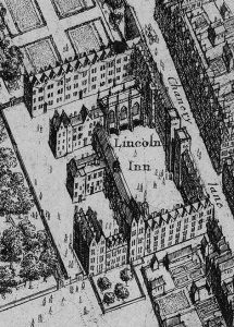
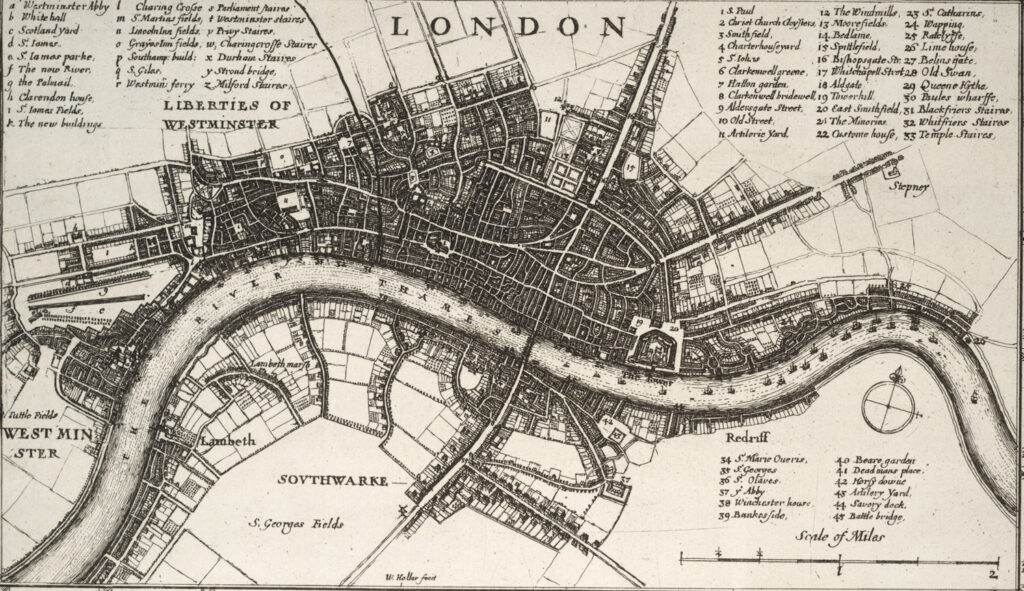
The layout of buildings inside the grounds of Lincoln’s Inn, including Trinity Chapel and the buildings adjacent to it, can be seen either in Wenseslaus Hollar’s map of Westminster from 1660 or in an early 19th century aerial view.

Lincoln’s Inn and other other Inns of Court were appropriately situated between the west wall of the City of London and the old Palace of Westminster, where the Houses of Parliament met in the 17th century, and the Palace of Whitehall, where the monarch had lived since Henry VIII.